A close-up of the area from The Maine Atlas and Gazetteer (DeLorme, 13th Edition, 2007):

Wendy will be on the Vineyard this week, so I'm going to see what I can do up in Maine. On Monday, July 8 I drove us down to Falmouth, and we had a great lunch at the Flying Bridge. Gave her a big kiss goodbye, and headed off-Cape, all the way around on 495, and up into Northern Maine:

which, of course, contrasts with my picture last October 24:

At 7 PM I checked into the Town & Lake Motel in Rangeley, Maine. The view from my room:

After a great dinner at Parkside & Main (steak tips and two glasses of milk), I headed off to bed.
Tuesday morning: up and at 'em, with a great breakfast at Keep's Corner Cafe & Bakery (they open at 6 AM!) Check out, and drive to hike Boundary Peak:

I'm going to describe the drive. It might get a little boring, but it's my blog:
Head west on 16 from Town & Lake Motel. At 6.2 miles (6.2 miles total), Route 4 continues straight, but you take a right (continuing on 16 West).
4.9 miles later (11.1 miles total) take a right on (dirt road) Morton Cutoff Road. This is where the Mile Markers start.
1 mile later (12.1 miles total) you pass Morton Cutoff Rd Mile Marker 1
1 mile later (13.1 miles total) you pass Morton Cutoff Rd Mile Marker 2
1 mile later (14.1 miles total) you pass Morton Cutoff Rd Mile Marker 3
0.2 mile later (14.3 miles total) you intersect (and cross over) Tim Pond Road
0.7 mile later (15.0 miles total) you pass Burnt Mtn Rd Mile Marker 4
1 mile later (16.0 miles total) you pass Burnt Mtn Rd Mile Marker 5
1 mile later (17.0 miles total) you pass Burnt Mtn Rd Mile Marker 6
1 mile later (18.0 miles total) you pass Burnt Mtn Rd Mile Marker 7
0.9 mile later (18.9 miles total) you pass Burnt Mtn Rd Mile Marker 8
2 miles later (20.9 miles total) you pass Burnt Mtn Rd Mile Marker 10
1 mile later (21.9 miles total) you pass Burnt Mtn Rd Mile Marker 11
0.2 mile later (22.1 miles total) go down-and-left to stay on Burnt Mtn Rd
0.8 mile later (22.9 miles total) you pass Burnt Mtn Rd Mile Marker 12
0.3 mile later (23.2 miles total) stay right to avoid a flagged hole-in-the-road on the left
0.5 mile later (23.7 miles total) stay left at fork
0.5 mile later (24.2 miles total) "Camp For Sale" on the right
0.7 mile later (24.9 miles total) DANGEROUS DITCH
0.1 mile later (25.0 miles total) BIG DITCH, then wooden slats bridge over rushing stream
0.1 mile later (25.1 miles total) go over a flagged culvert
0.1 mile later (25.2 miles total) drive over wooden slats bridge (over dry river bed)
then continue on this road through the woods, alongside a stream/river on your right
0.5 mile later (25.7 miles total) you come out of the woods. Angle right onto Big Canyon Road (7.5 miles to the end)
approx. 2.3 miles later (28.0 miles total)
DO NOT TAKE (Do not go straight onto) Megantic's Winter Rd. Stay right on Big Canyon Rd (no sign)
Don't worry about going E or even SE
1.9 mile later (29.9 miles total) take downward left
0.1 mile later (30.0 miles total) merge onto road coming in from the right
(once again, don't worry about going E or even SE)
2.9 mile later (32.9 miles total) Cloutier Rd goes off to the right
0.3 mile later (33.2 miles total) Porter Brook Rd goes off to the right (excellent bridge over Porter Brook)
0.2 mile later (33.4 miles total) dead-end at rocks at Porter Brook:

I'm kind of tired of bushwacking through the woods (if I don't have to), so the plan for today's hike is to hike north on the "road" until I get to the Border, then just follow the border east and then north. At least I won't get lost:

I used my flip-flops to cross the brook, then put on my hiking boots on the other side:

It was pretty hiking down the "road":


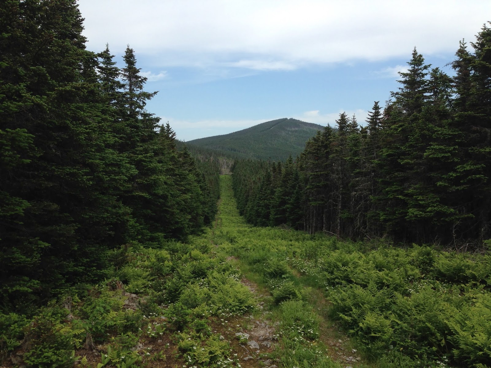
At 10:20 I reached THE BORDER:

THE BORDER is just a cleared area, like what you see under power lines:

but it does have its ups-and-downs:

There are Boundary Markers every mile:

and obelisks every once in a while:


After 2 hours of hiking, I finally reached my "east corner" at 11:30:

Big Difference between NOW and last October 25:

Right around the corner I got my view of the rest of this hike:

Yes - I'm heading all the way to that tiny notch in the far upper right!
Examining the map:

The lower oval is in a VERY WET area, and my boots got soaked. The upper oval, with the elevation lines so close together, was a Super Hard climb, and took me about 1/2 hour to climb 1/2 mile. And my butt/thigh/leg were kind-of starting to hurt.
Looking forward at 12:45:
And I finally reached the peak at 1:20:

(Boundary Peak is also know as Panther Peak)
Cool views on my way back down:


I wound up getting back to the car around 4:30 - 14.24 miles in 6 hours 56 minutes. WOW - I'm wiped and am heading home. We'll get #100 another day.
I passed some beautiful wildflowers on the logging road on the way out:

And I saw a bear scamper of into the woods on my left:

Passing thru Gorham, New Hampshire, I hit 55,555 miles on the Crosstrek:

Home and in bed by midnight. WOW - Thank you GOD for these wonderful adventures!
Today's music was WRGY 90.5 FM "Rangeley Community/Educational Radio", which was GREAT until I drove west out-of-range. Then it was music from my mp3 cds:
Bruce Springsteen - In Concert/MTV Plugged, 1993

Hootie & the Blowfish - Cracked Rear View, 1994 debut album

Jimmy Buffett - Fruitcakes, 1994

Paula Cole - Harbinger, 1994

Bruce Springsteen - Human Touch, 1992

Joni Mitchell - Ladies of the Canyon, 1970

Neil Young - Live Rust, 1979

Bonnie Raitt - Longing in Their Hearts, 1994

Stevie Ray Vaughan and Double Trouble - The Sky Is Crying, 1991

The Cranberries - To the Faithful Departed, 1996

The Who - Who Are You, 1978


