Mounts Willey, Field, and Tom are on 302 in Crawford Notch State Park. east of Cannon Mountain, and just south of Bretton Woods Ski Resort and the Mount Washington Hotel

Since I wanted to start at the southern entrance (trailhead for the Willey Range Trail), go hit the three peaks, and return down the Avalon Trail, I parked near the AMC's Highland Center and rollerbladed down 302. Parked, with Mount Tom in the background:

and heading down 302:


WARNING - it is VERY STEEP, and I quickly had to bail out and put on my hiking boots to walk down about a mile. At that point, it leveled out, and I put the blades back on for the next 3 miles. The 4 miles took 40 minutes, and I put the blades and helmet behind a tree.
I used Map My Walk - the whole trip took 4 and 1/2 hours (9.15 miles hiked) and covered about 5,980 feet in climbing elevation (2960 up, 570 down along the ridge, 330 up, then 2120 down to the car):

Going up 93 to 495, I filled up at the AVSG station in Tewksbury, then headed north back on 93 at 62 mph; took Route 3 east at Cannon Mountain, then south on 302 past Bretton Woods & the Mount Washington Hotel (144 miles from Tewksbury). Hiking up the Willey Range Trail seemed pretty easy

until it wasn't:

The rocks and trees with moss reminded me of Asher Durand paintings:


"Study of a Wood Interior", c. 1855, Addison Gallery of American Art, Andover, MA
The view of rain clouds coming through Mount Washington Valley is pretty impressive (I never saw lightening!)

and I got to the top of Mount Willey in a light rain:

and a short time later over to the top of Mount Field:

Going through the forest as the fog/steam/rain burns off

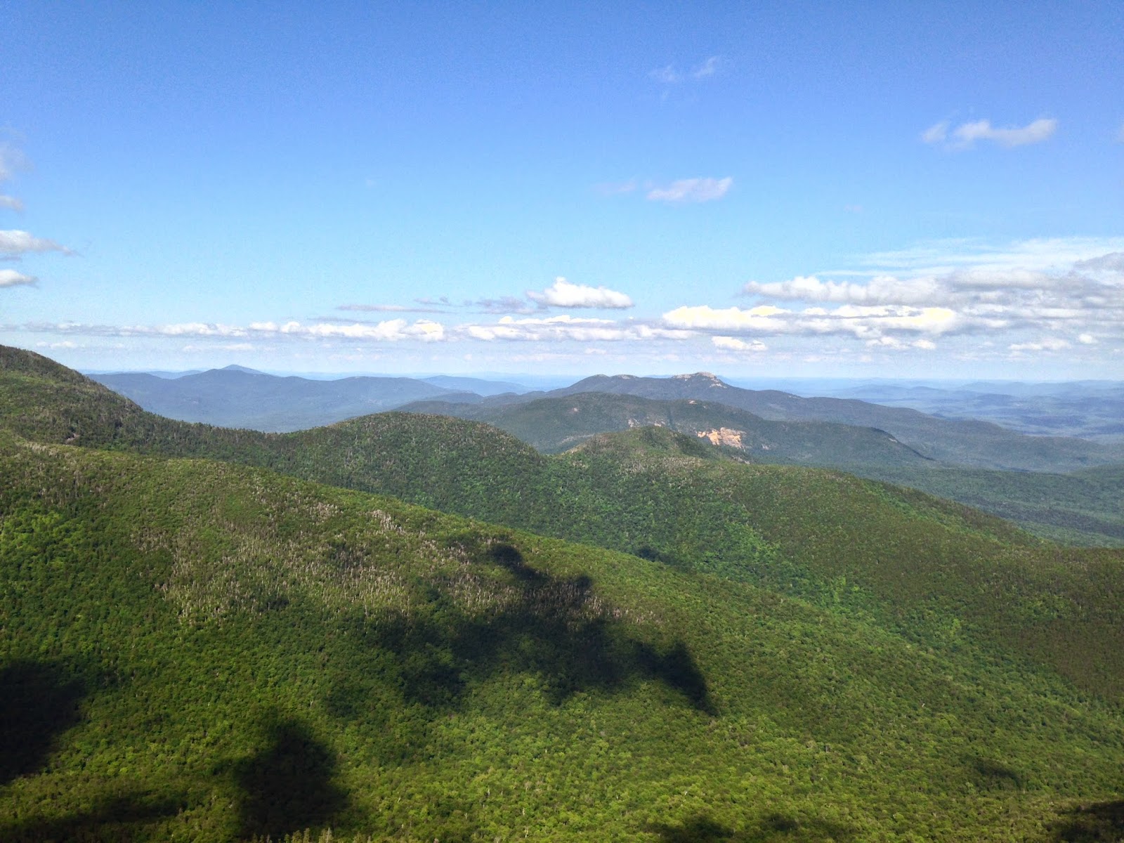
The view from the top of Mount Tom


some nice streams coming back down:

and some cascades that Wendy and I can visit next June:

and a final selfie at the end of a great day!

Thursday, July 24, 2014
Boston, MA
30 miles -- up 93, south on 495 to Tewksbury (1/2 hour)
144 miles -- up 93 North to Exit 35 onto Route 3, then Route 302 to AMC Highland Center (2 1/2 hours)
4 miles rollerbladings on 302 -- to Mount Willey trailhead (40 minutes)
9 miles -- hiking (4 1/2 hours)
4 miles/10 minutes -- back to pick up rollerblades and helmet
3 1/2 hours -- to get home
here is today's playlist:
Actually, I am currently listening to all my songs, in alphabetical order. I continue in the C's today: from "Cookie Jar" by Jack Johnson (On & On album) through some Aaron Copland (Appalachian Spring Suite; Fanfae for the Common Man; Rodeo) through 4 versions of "Cowgirl in the Sand" (including a killer version by Neil Young & Crazy Horse at the Fillmore East in 1970) to "The Crane Wife 1, 2, and 3" by The Decemberists (we All Raise Our Voices To The Air: Live Songs 04.11-08.11).