
After Mount Whiteface, Mount Passaconaway is the 2nd southernmost 4000 footer. From Boston, go 103 miles up 93 to exit 24, then northeast for 27 miles to get to the Ferncroft Road parking lot (beautiful drive on 113 around the north side of Squam Lake)

I used Map My Walk - the whole trip took 5 hours (11.1 miles hiked) and covered about 5,800 feet in climbing elevation (2,900 up, then return):

It should be a nice hike up Wonalancet Range Trail, then Walden Trail, then Dicey's Mill Trail back down:

The trail started out very flat and wide through the forest, but then turned into a "real" hiking trail up the mountain(s). Although almost always in the woods, there is little "view-break" going up:

Getting up to Mt. Passaconaway, I had to hit Mt. Wonalancet (2760'), Hibbard Mtn. (2940'), and "Nanamocomuck" (3320'). You can save 0.4 miles by taking the "short cut" around Mt. Wonalancet, but DON'T - you will miss a beautiful view on a nice granite outcrop:


then just turn around and head back up into the woods (see the blue blaze!):

I saw maybe a dozen toads (jaguar markings), plus a lot of scat (I should email Doug out in Estes Park, but maybe "East Coast scat" is different from "Rocky Mountain scat"). Steep climb towards the top, but great views:

on the back (north side) of Mt. Passaconaway is a 0.3 mile trail marked "View" - hike to it! Do Not Just Be A Peak-bagger!! Look at the VIEW!! The lake is Church Pond, the closer bare-patches is Potash Mtn (2680') and the bare-peaks in the distance is Green's Cliff (2926'):

turning to the right, the wilderness spreads out below me:

and those outcropings are Hedgehog Mtn (2532') and its East Legdes:

I had to take 3 selfies. These summits have no signs, but usually there is a cairn - pretty modest in this case (I'm lying on the ground!):


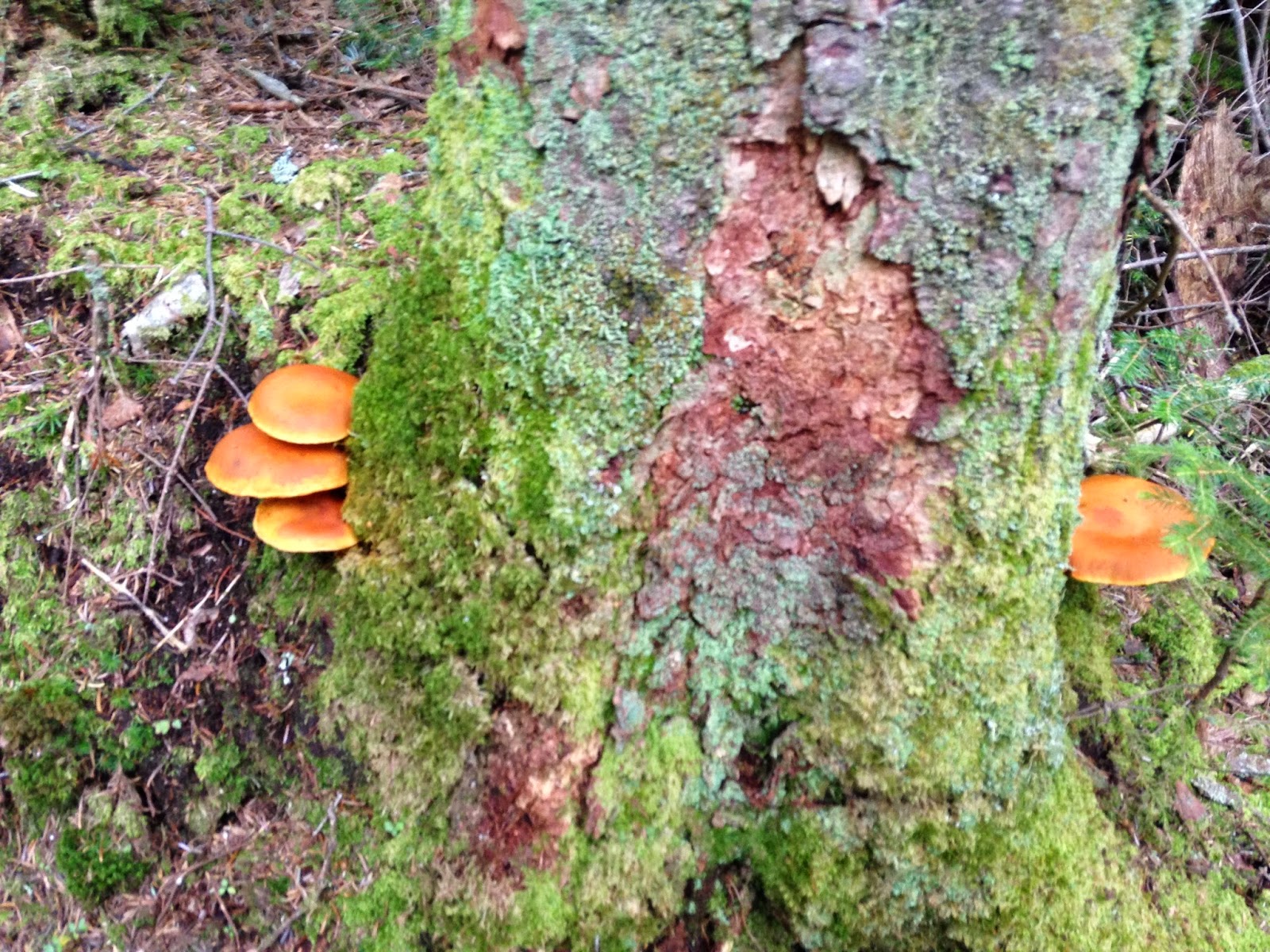
I headed down the west side of the mountain. Do not ignore the beauty of the woods! These mushrooms were brilliant orange, set against the bight mossy greens:
It took me between 30-and-40 minutes per mile to get to the top, and also down the steep west/southwest side. But as soon as I got to Dicey's Mill Trail, it leveled-out (relatively), and I just FLEW down the trail (15-to-28 minute miles). And crossed a beautiful stream:

The trail finishes in a field - a lovely way to end the day!

Thank you God for a GREAT DAY!
Thursday, August 21, 2014
Boston, MA
103 miles -- up to Exit 24, 93 North (2 hours)
27 miles onto 25, then 113 -- to Mount Passaconaway trailhead (1 hour)
11.1 miles -- hiking (5 hours)
27 miles/1 hour -- back to 93 South
2 1/2 hours -- to get home
here is today's playlist:
Continuing to listen to all my songs, in alphabetical order. I was in the D's today: I started with "Daughter" by Pearl Jam, and ended the day with "Dear God" by Sarah McLachian.
No comments:
Post a Comment