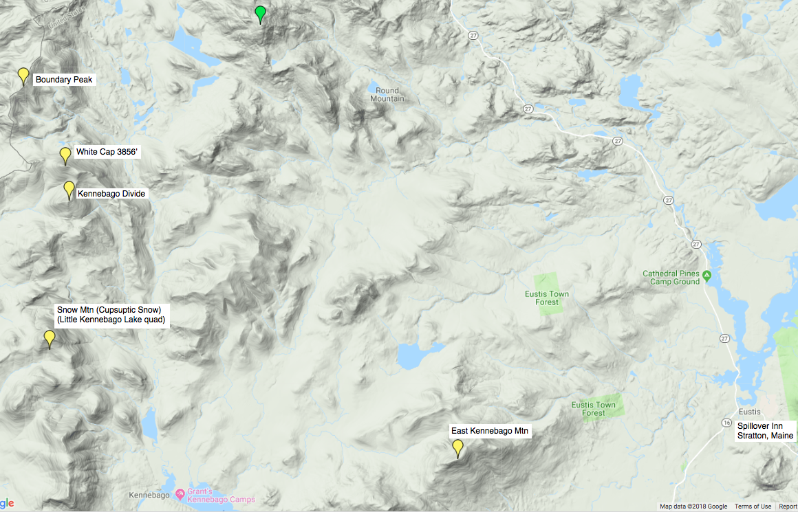
This map shows the 5 unclimbed mountains in yellow, plus the Spillover Inn, where I'll be staying Wednesday and Thursday nights. I plan on hiking Snow Mtn (Cupsuptic Snow) on Wednesday, Kennebago Divide, White Cap 3856' and Boundary Peak on Thursday, and finishing off with East Kennebago Mountain on Friday (and COMING HOME!).
A close-up of the area from The Maine Atlas and Gazetteer (DeLorme, 13th Edition, 2007):

I left Manchester-by-the-Sea around 8:15, and made it to MEXICO by noon:

Ha Ha - "Mexico, Maine"!
Just north of Mexico I started seeing the snow up in the mountains:

Plenty of "Fall Beauty" still in Maine:

But not for very long:

A fun "Scenic View" just southwest of Rangeley, Maine:


I can't wait to see what it's like UP IN THE MOUNTAINS!! (At 37℉, the snow flurries started right after I took that picture.)


From Maine Hwy 17 West, you zig-and-zag onto Maine Hwy 16 West (which actually goes northwest at this point). After 4.8 miles, take a right on Morton Cutoff Rd:

You then wind around on Logging Roads until you get to East Branch Road:

which is a pretty nice road:

until Winter sets in:


I have done a lot of reading, and printed 2 maps-with-gps-tracks (including a "recommended start" for heading North):

I started east/northeast on the logging road a little after 2 PM, and 40 minutes later I was in a Winter Wonderland, heading North up the Mountain:

Go under the tree:

and keep "Heading Up":


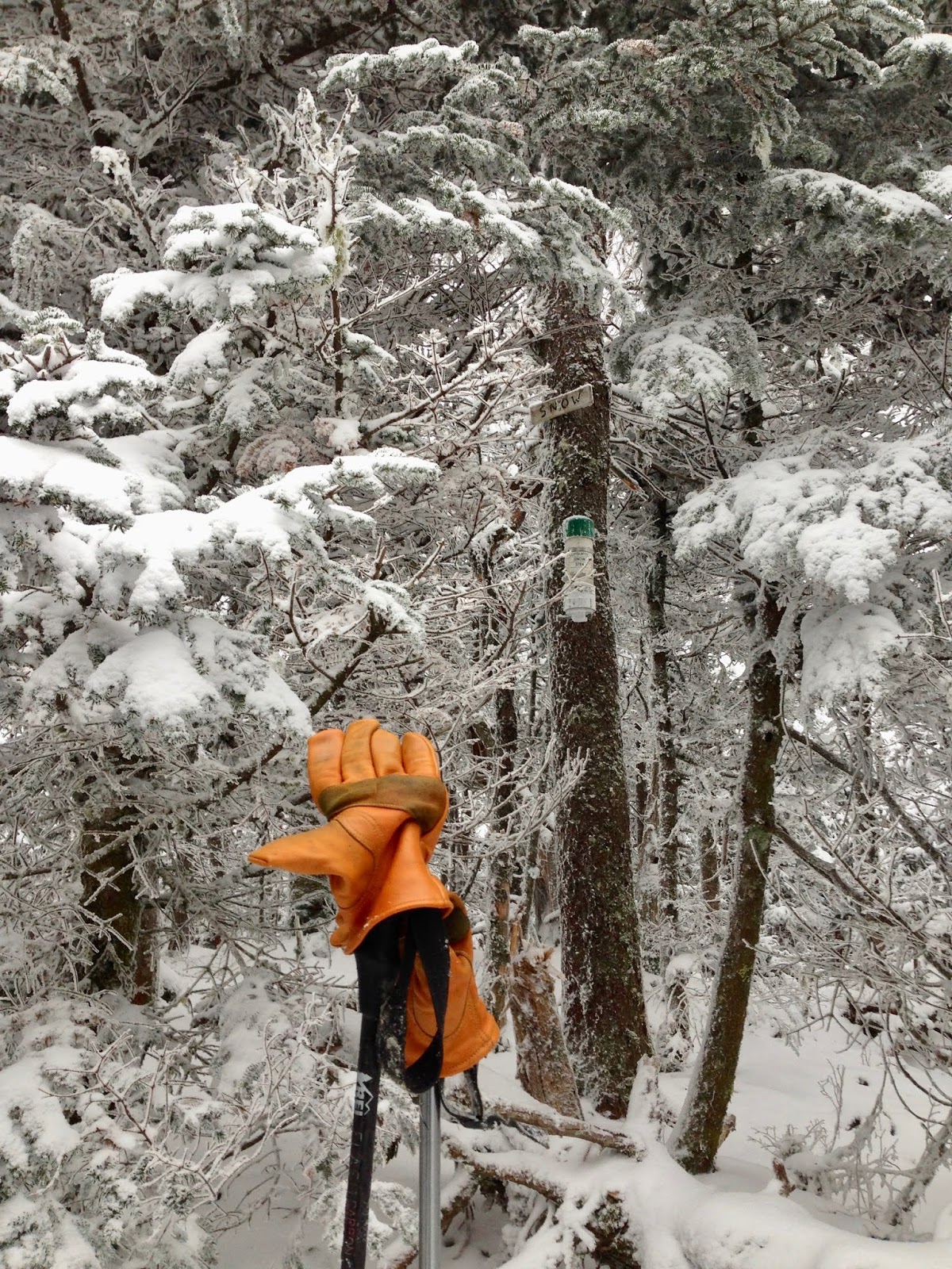
By 3:30 I was on the "ridge path", heading east, trying to find the canister and sign:

SUCCESS 15 minutes later!!


I came blasting back down the mountain, through snow and trees, and cutting areas, and streams. I intersected the logging road just a little west of my entry point, then followed my footprints back to the car. 1 hour 35 minutes up to the summit, and only 1 hour back down! When I approached the car, I realized I had been so excited on the summit that I had forgotten to pull out my sign:

A couple of screenshots of my track on Google Earth:


This would have been a MUCH HARDER hike in the summer. I had on multiple layers of clothing, and I was well-waterproofed, and my LL Bean boots allowed me to walk in streams with impunity. The layers allowed me to walk through all the saplings/growth without any worries (or scratches).
I headed back down the Logging Roads ("East Branch Road", "Burnt Mountain Road", and "Morton Cutoff Road"). The map shows a place-on-the-river called "Big Falls":

Well, there wasn't a town - there wasn't a bridge - there was barely a turn-out - but it is a really nice area along the Cupsuptic River:


I think that I would really like to come back up here (IN WARM WEATHER) and climb around these rocks, and get a better view of these Falls.
Down through Rangeley, and northeast to the Spillover Motel in Stratton, Maine. A nice hot bath and then dinner at "The Stratton Inn". WOW - Thank you GOD for these wonderful adventures!
Today's music:
Love - Love Story 1966-1972 anthology album

various artists - Lost Mixes: Extended Ecstasy, 1994

various artists - Lost In Translation, 2003 soundtrack album
ethereal, moody, textured. Check out the band "My Bloody Valentine".
Joe Walsh - Look What I Did!, 1995

Joe Jackson - Look Sharp!, 1979 first album

The Doobie Brothers - Long Train Runnin': 1970-2000 (4 cds)

No comments:
Post a Comment