
the last 40 minutes was 8 miles on a dirt road - Success Pond Road:

Having said that, for a dirt road, it is actually quite nice:

From the parking area, I covered (clockwise) 8 miles in 4 hours:

As is stated in the AMC's Maine Mountain Guide, "This trail [Carlo Col Trail] ascends to Mahoosuc Trail at the small box ravine called Carlo Col, and, in combination with Goose Eye Trail, makes possible a scenic loop over Mt. Carlo and Goose Eye Mtn."
Hey, I like "scenic loop"!
And my hike/path matched up pretty well with the AMC map:

YAY Maps!
I'm pretty sure the writer of the Maine Mountain Guide is from Maine:
The Goose Eye Mtn. section includes the phrases "This striking mountain ..." and "... excellent panoramic views ..."
The Goose Eye Trail section includes the phrases "... scenic summit.", "... enters a fine hardwood forest.", "... has magnificant views in all directions."
The Carlo Col Trail section includes the phrase "... a scenic loop ..."
I love it when the signs are easy:

Hiking up the old logging road, with Goose Eye Mountain in the distance:

Really? I'm going to hike to the top of that thing?? It must be 100 miles away!
Pretty soon I reached the turn-off for Goose Eye Trail:


You quickly cross a beautiful little stream:

You then go down another logging road for a little bit, before diving back into the woods on the right. Very Official Signs!


45 minutes into the hike (about 2 miles) I'm climbing up a very nice trail:

after the first kind-of-hard uphill, the trail flattens out for a while:

But then it has a final hard-uphill part. This is one of my uphill-downhill pair of pictures:


and then raise your head and look at the view into the Maine North Woods (?and Canada?):

7 minutes later I was on the summit of Goose Eye - along with 8 TEENAGE GIRLS FROM A CAMP!!!:


Yes, there are "... excellent panoramic views ...":
looking northwest at Success Pond:

looking northeast at the other mountains in the Mahoosuc Range:

looking east to the East Peak of Goose Eye - I'm going that way but not as far as the peak:

sort-of-a-stitched photo looking south, to Mount Carlos:

On the mountain ridge heading east to the AT:

At the intersection with Mahoosuc Trail (the AT), looking south:

Yes, that's the ladder I went down:

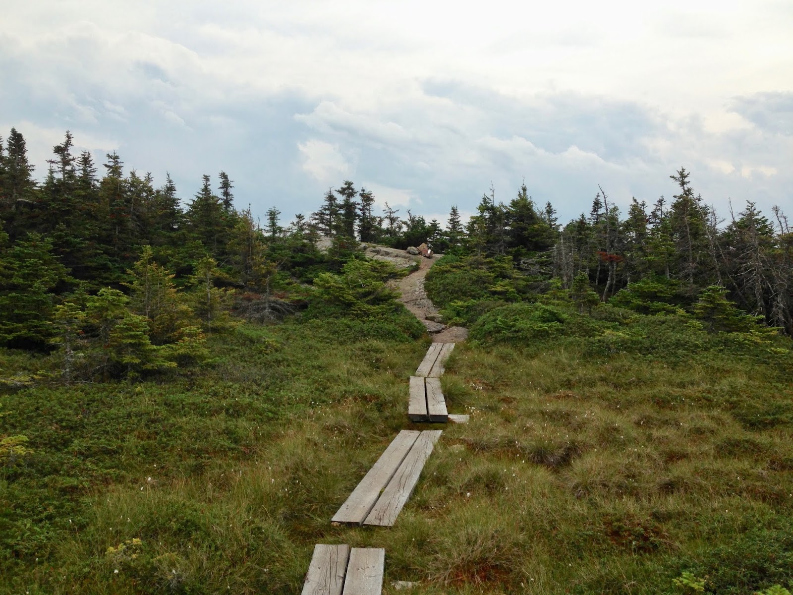
Nice open hiking:

I don't know - if it looks like mud, it probably is mud. Don't step in it:

Nice last section up to Mount Carlos:


One hour from Goose Eye Mtn.
The trees have grown, so there is not much of a view on Mount Carlo, so I headed down to the intersection with Carlo Col Trail:


It is a really nice trail going down, with many "new" sections:

and crosses a nice brook a few times - very refreshing to splash with:

Back on the logging road to the car:

beautiful day - finished 8 miles in 4 hours!
If I left the house at 6:30, had a 4 hour hike, and got home at 7:30, that means I had 9 hours driving (not 7 1/2 estimated). One reason was 5 PM traffic in North Conway:


DON'T HIT THE LITTLE KIDS!!
My (old) pair of boots wound up getting kind-of beat up

Thank you GOD for this wonderful adventure!
Today's driving music was albums by Cream, Blind Faith, and Traffic:
Cream - Fresh Cream, 1966

Cream - Disraeli Gears, 1967

Cream - Wheels of Fire, 1968 double album, studio & live

Because I do not have their 4th album (Goodbye), I switched to Blind Faith - Blind Faith, 1969

I listened to Traffic on the way home:
Mr. Fantasy, 1967

Traffic, 1968

Having heard many of the songs on WBCN, I REALLY LIKED this album when I finally got to rip it.
Last Exit, 1969

John Barleycorn Must Die, 1970

Welcome to the Canteen, 1971 live album

The Low Spark of High Heeled Boys, 1971

The Last Great Traffic Jam, 2005 live album (1994 concerts)

No comments:
Post a Comment